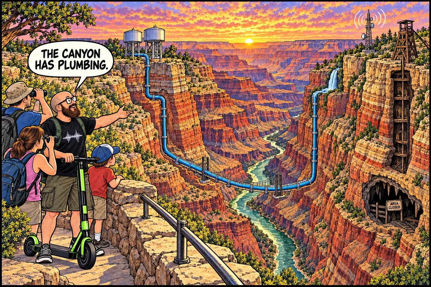
Water lines. Radio sites. Uranium. Closed caves. The parts nobody puts on the postcard.
Grand Canyon: Hidden Infrastructure
The water lines, radio sites, uranium mines, closed caves, and restricted areas that keep Grand Canyon National Park running, and the documented reasons some of it is off-limits.
Start with these
Grand Canyon's Water System: Sourcing, Treatment, Distribution
How Grand Canyon National Park sources, treats, stores, and delivers water and wastewater across all four rim and inner-canyon developed areas.
Open the dossier →The Transcanyon Waterline: One Pipe, One Canyon, No Backup
How a 1960s aluminum pipe across the Grand Canyon came to supply every South Rim facility, why it broke 85-plus times, and what the August 2026 flood did to its $208 million replacement.
Open the dossier →Roaring Springs: the Spring That Ran the Whole Park's Water
A North Rim spring that supplied all of Grand Canyon's piped water for decades, staffed by a live-in caretaker for 33 years, now off-limits and mid-rebuild.
Open the dossier →Inner Canyon Water: Pipelines, Tanks, and a Bridge That Hides a Pipe
How water gets pumped and piped through the canyon corridor, from a 1932 railroad system to the $208M rebuild and the 2026 flash-flood damage.
Open the dossier →South Rim Water Tanks: Storage, Stage 4, and the 2026 Water Emergency
Two fenced tanks near Trailer Village hold all the South Rim's water. In 2025-2026 they ran low four separate times.
Open the dossier →North Rim Water Infrastructure — Roaring Springs, the Pipeline, and the 2025 Fire
The North Rim's water comes from Roaring Springs via a 1960s pipeline. A 2025 wildfire destroyed the treatment plant; potable water is still out in 2026.
Open the dossier →Phantom Ranch Utilities — Water, Power, Sewage, and the 2026 Flood
A century of improvised water, power, and sewage at the bottom of the canyon, and what August 2026's flash flood destroyed and spared.
Open the dossier →South Rim Wastewater Treatment Plant — process, lagoons, and a 2025 PFAS finding
The South Rim's fenced 1972 wastewater plant, its lagoons, and a 2025 USGS study that traced PFAS and drugs from its effluent into a nearby spring.
Open the dossier →Desert View Wastewater System — What's Actually on the Record
A fenced lagoon plant off Cedar Mountain Road is the least-documented wastewater site in the park. Here's exactly what is and isn't public.
Open the dossier →The 1926 Plant That Turned Sewage Into the South Rim's Water
A railroad-built plant reclaimed wastewater for a rim with no natural water supply, ran trouble-free for 46 years, and is now a fenced historic district.
Open the dossier →Power and Electrical Infrastructure Throughout the Grand Canyon
From a 1926 railroad powerhouse to a 2024 substation upgrade, how the South Rim, North Rim, and inner canyon actually get electricity.
Open the dossier →Utility Tunnels, Conduits and Buried Infrastructure at Grand Canyon
There's no secret tunnel network. There is a 1926 buried power cable, a phone line made of pipe, and a shared trail-side corridor a century old.
Open the dossier →Grand Canyon's Radio System: Fire Towers, Dead Zones, Upgrades
How Grand Canyon's radio network grew from 1909 fire lookouts into a patchy digital system that still can't cover the whole canyon.
Open the dossier →Hopi Point: From 1909 Fire Lookout to Closed Radio Repeater Site
A tree-platform fire lookout from 1909 became one of the South Rim's four primary radio sites — and it's fenced off for exactly the reason NPS says.
Open the dossier →Four Channels, One Canyon: Grand Canyon's Rescue Radio Network
Law Enforcement, Fire, Medical, Administrative, and a tactical channel — the radio structure behind roughly 300 rescues a year.
Open the dossier →Grand Canyon's Shared Interagency Radio and Dispatch Network
How Grand Canyon's radio system shares towers, dispatch, and rescue response with the Forest Service, BLM, Arizona DPS, a sheriff, a tribal agency, and a neighboring park.
Open the dossier →Grand Canyon's Cellular Coverage: One Carrier, Five Possible Towers
Grand Canyon offered cellular service from just one carrier over a shared 850 Mbps pipe. A 2020 federal plan approved up to five new towers, built permit by permit.
Open the dossier →Grand Canyon's Hidden Microwave Links, From the Rim to Phantom Ranch
Grand Canyon's towers reach the outside world via line-of-sight microwave links, including a dish at Phantom Ranch that has quietly carried phone calls from the canyon floor for years.
Open the dossier →The Trans-Canyon Telephone Line: mule-maintained since 1935
A 1922 tree-strung wire became a CCC-built copper line on 592 pipe poles, rescued hikers for decades, and is now a mapped aircraft hazard.
Open the dossier →Grand Canyon's fiber and cell plan: approved in 2020, still mostly paper
NPS approved a framework for new towers, small-cell nodes, and fiber cable in 2020. Five years later, evidence any of it got built is thin.
Open the dossier →The room that answers when the Grand Canyon calls 911
Eight dispatchers, a prevention program born from a deadly 1996 summer, and the August 2026 flood that tested both when the sensors failed.
Open the dossier →Aviation Communications and Grand Canyon Air Operations
Two midair collisions, 30 years apart, built the flight rules that govern every plane and helicopter over the canyon today.
Open the dossier →Grand Canyon's Aviation Operations Area and its short-haul rescue crew
A fenced helibase runs one of the busiest non-military federal flight programs, training rescuers who dangle from a rope to reach places helicopters can't land.
Open the dossier →Helipads and Remote Helicopter Sites at the Grand Canyon
One named helistop, one fenced helibase, and a federal flight-free zone dating to two mid-air disasters. Where the canyon's helicopters are actually allowed to land.
Open the dossier →Grand Canyon's NPS Maintenance Yards: Two Generations of Work
From village shops to the Mission 66 yard and a newer facilities complex: what park records show, what changed, and what remains closed to visitors.
Open the dossier →Grand Canyon's Wildland Fire Base: Inside the Fenced South Rim Compound
A fenced South Rim compound houses the park's fire base, fuel yard, and shuttle barn — and why it's closed, from the fire program to Dragon Bravo.
Open the dossier →South Rim shuttles: the nation's second-busiest park transit system
7.6 million riders a year, one contractor since 2000, and a bus compound fenced off from the very visitors it moves.
Open the dossier →Service Roads and Restricted Government Roads of the Grand Canyon
Behind the two public highways sits a second network of gated fire roads, firing-range roads and wilderness closures. What's shut, to whom, and why.
Open the dossier →Lees Ferry, the gauge, and the bridges that run Grand Canyon's river
A 1921 streamgage sets interstate water law, and a bridge built by hand and Havasupai shoulders still carries the only foot crossing at river level.
Open the dossier →Trail Maintenance, Ranger Stations and Remote Caches of the Canyon
CCC rock shelters still shelter hikers, a 1966 ranger station still runs, and a century-old station is still protected by name in the park's current rulebook.
Open the dossier →The Orphan Mine: Copper Bust, Uranium Boom, Radioactive Fence
An 1893 copper claim on the South Rim became one of the richest uranium mines in the country, then a cleanup the Park Service is still fencing, monitoring, and gluing down today.
Open the dossier →Bass Asbestos Mine: William Bass's trail-and-tram asbestos claim
A trail-builder's side-hustle asbestos claim in Hakatai Canyon, sold for wartime prices in 1917-1918, now a 500-foot no-entry buffer in the park's rulebook.
Open the dossier →Hance Mine: the asbestos claim behind the canyon's first tour guide
John Hance mined asbestos near Sockdolager Rapids, sold out in 1901, and became famous for storytelling instead. The river corridor there is now a hard closure.
Open the dossier →Grand Canyon's mine inventory: 38 sites, 75 features, by the numbers
NPS has counted 75 abandoned mine features across 38 sites in the park, part of a 37,050-feature nationwide problem. Here's the public accounting.
Open the dossier →Uranium mining around the Grand Canyon: mines, monument, and 2026
How uranium in Grand Canyon breccia pipes led to a 2012 mining withdrawal, a 2023 tribal-backed national monument, and Pinyon Plain Mine, still pumping and mining ore in 2026.
Open the dossier →Abandoned mine hazards and how the Grand Canyon closes them
Why every mine in Grand Canyon National Park is closed to the public: the hazards, the 1872 law behind them, and how NPS actually shuts one down.
Open the dossier →Former South Rim Landfill: from flatcar dumping to a transfer station
A closed South Rim landfill traces back to open dumps and a 1926 railroad-funded incinerator, not a Superfund emergency.
Open the dossier →Marble Flats Landfill: the North Rim's quiet, closed old dump
Off a fire road near the Widforss Trail, a small closed landfill traces the North Rim's slow, late build-out of its own utilities.
Open the dossier →Lindbergh Hill Landfill: a closed North Rim dump, and an open question
A gated old landfill near the North Rim Entrance Road is well documented; the hill it's named for, and why, is not.
Open the dossier →Grand Canyon contaminated sites: why none are on the Superfund list
None of Grand Canyon's mine, landfill, or wastewater sites are on the federal Superfund or Arizona state cleanup lists. Here is who runs the cleanups instead.
Open the dossier →South Rim Firing Range — Why It's Closed Around the Clock
A fenced range and access road on the South Rim, closed to the public at all hours so rangers can train and qualify on firearms without endangering visitors.
Open the dossier →North Rim Firing Range — The Same Closure, a Thinner Record
The North Rim's own closed firing range, restricted under the same rule as the South Rim's, with a much thinner public paper trail.
Open the dossier →Little Park: the North Rim's Bison Capture Corral
A closed North Rim meadow hides a livestock corral built to catch wild bison descended from a 1906 failed cattle-crossbreeding scheme.
Open the dossier →Government Storage Areas at Grand Canyon: What's Actually Fenced Off
The park's closure list names exactly one general government storage site, South Gate. Here's what the public record says about it and what it doesn't.
Open the dossier →Restricted Maintenance Compounds: The South Rim's Working Backside
One closure notice covers the maintenance shops, fuel point, shuttle yard, fire base and aviation area behind Grand Canyon's South Rim. Here's what it actually says.
Open the dossier →The One Time Grand Canyon's Rulebook Says "Critical Infrastructure"
The park's closure rulebook uses the phrase only once, for one pumphouse — every other infrastructure closure runs on the same law, different wording.
Open the dossier →The Full Catalog: Every NPS Closure in the 2026 Compendium
All 49 numbered closures from Grand Canyon's official compendium, organized by district with the stated reason and CFR citation for each.
Open the dossier →Cave of the Domes: the last open cave, and why bats closed it
The one Grand Canyon cave you didn't need a permit for survived a hantavirus scare but not white-nose syndrome.
Open the dossier →Why almost every Grand Canyon cave is legally off-limits
A 1988 federal law makes cave locations confidential; the park's own rule goes further and requires a permit just to walk in.
Open the dossier →Grand Canyon caves: mapped systems and documented research
Rampart's Ice Age fossils, Stanton's collections, growing Leandras and Double Bopper surveys, and what cave biology and park rules actually establish.
Open the dossier →Mines vs. Natural Caves: How Grand Canyon Tells Them Apart
Federal and park rules define caves and mines differently, deciding who needs a permit, why a site is closed, and how NPS counts what is underground.
Open the dossier →Bats, White-Nose Syndrome, and Why Grand Canyon Caves Stay Shut
A cold-loving fungus that has killed millions of bats nationally was confirmed in Arizona in 2025, and Grand Canyon's caves are built to keep it out.
Open the dossier →Anasazi Bridge: What's Actually Documented, and Why It's Closed
A federally closed cultural site in the Redwall formation, and an honest look at how thin the verified public record on it really is.
Open the dossier →Hopi Salt Mines: Closed by Federal Order, Explained by the Tribe
Why this site is closed in the tribe's own public words, not NPS guesswork — cultural significance, a federal closure, nothing invented.
Open the dossier →Furnace Flats: The Thin Public Record Behind a Real Closure
A federally closed cultural site with almost no public detail beyond the closure order itself, and what a 2007 dig actually documented there.
Open the dossier →Archaeological-Site Protection Throughout Grand Canyon
4,000+ documented sites, the federal laws that guard them, and the dam upstream slowly undoing decades of natural preservation.
Open the dossier →Why Grand Canyon Cultural Closures Give No Details
The federal laws — ARPA, NHPA Section 304, NAGPRA — that make withholding site details legal, not evasive.
Open the dossier →Grandview, Hermit Camp, and Bass Camp: Ruins Left in the Open
A mine, a burned-down luxury camp, and a pioneer's river-crossing rigs — three documented ruin sites, none of them fenced, all protected by federal law.
Open the dossier →Havasupai Lands: Supai Village, the Mule Mail, and a Sovereign Reservation
Supai village isn't part of Grand Canyon National Park. It's Havasupai tribal land, reached by an 8-mile trail, run on the Tribe's own permits and infrastructure.
Open the dossier →Hualapai Lands: The 108-Mile River Boundary Nobody Ever Settled
The Hualapai Tribe's reservation runs 108 miles along the Colorado River, home to the Skywalk and a river boundary the NPS and the Tribe still don't agree on.
Open the dossier →Navajo Nation lands at the Grand Canyon's eastern edge
A tribal park, separate permits, and a contested historic boundary show why an NPS pass cannot stand in for Navajo Nation permission.
Open the dossier →Tribal vs. NPS Jurisdiction at Grand Canyon: How the Map Works
Eleven tribes border or hold rights inside the park, and two boundary lines — Hualapai and Navajo — are still legally disputed with NPS.
Open the dossier →Infrastructure That Crosses Grand Canyon's Tribal-NPS Lines
The power line, fiber route, and planned water pipeline that cross from federal or tribal land onto Havasupai and Hualapai land to serve those communities.
Open the dossier →Who keeps water, roads and broadband running near the canyon?
Tribal governments near the Grand Canyon manage distinct village services. Supai's water system, Hualapai public works and Hopi utility projects are not park infrastructure.
Open the dossier →Redwall Cavern: the river-carved amphitheater that isn't a cave
A limestone alcove at River Mile 33 that Powell guessed could seat 50,000 people — day-use only, no camping, and not legally a cave.
Open the dossier →Nankoweap: four named campsites guarding a thousand-year-old granary
Ancestral Puebloan granaries above the river, a hard hike, and a river-corridor camping system limited to four named sites, one party each.
Open the dossier →Little Colorado River confluence: habitat, law and the mixing line
The Little Colorado confluence is chub habitat and a Navajo sacred site. Here's what the park's 2026 channel, wading and camping rules actually say.
Open the dossier →Shinumo Creek: A 100-Yard Camping Rule Over a Torn-Down River Crossing
A narrow modern setback rule sits where William Bass ran a cable crossing and orchard that completed the canyon's first rim-to-rim trail.
Open the dossier →Elves Chasm: The Camping Rule and the Delisted Snail
Elves Chasm has a camping closure, protected wetland plants, a snail delisted for taxonomy rather than recovery, and some of the canyon's oldest rock.
Open the dossier →Tapeats Creek: Day Visits, Designated Camps and the River Rule
Tapeats Creek is open for river-trip day visits, but not river-trip camping at the confluence. Backpacker sites and a separate Thunder River camping closure follow different rules.
Open the dossier →Deer Creek: Why the Narrows Are Closed to Climbing and Rappelling
A river-mile 136.9 waterfall hike stays open, but the slot canyon below it is closed by federal rule to protect a site the Kaibab Band of Paiute Indians calls sacred.
Open the dossier →Kanab Creek: Day Use at the River, Wilderness Beyond
Kanab Creek has a defined NPS river-trip camping restriction at its mouth and a separate BLM/Forest Service wilderness upstream. Here's what each rule actually covers.
Open the dossier →Matkatamiba Canyon: Day Use, Not Overnight Camp
Grand Canyon's 2026 compendium bars camping at Matkatamiba but does not bar daytime visits. Two rulebook entries spell out the distinction; neither explains the original reason.
Open the dossier →Havasu Creek: Floods, Tribal Jurisdiction and a Camping Closure
Havasu Creek is tribal homeland, a flood-prone tributary and a monitored river system. The park's lower-creek camping rule is not a blanket visitation ban.
Open the dossier →Sentry milk-vetch: the protected ground at the Grand Canyon rim
Why a South Rim plant area is closed, how parking-lot removal aided restoration, and why old population figures and recovery targets mislead.
Open the dossier →Kanab ambersnail habitat: the flood and the delisting
A canyon spring snail shaped dam-flow decisions. Its 2021 federal delisting changed a taxonomic label, not the condition of its wetland habitat.
Open the dossier →Wildlife-management infrastructure: corrals, weirs and field tests
How Grand Canyon managers use bison corrals, fish weirs and research exclosures—and why the regional condor release pen is outside the park.
Open the dossier →What Grand Canyon's Weather and Air Stations Actually Measure
Rim weather, river-corridor research stations and air monitors tell different stories. Historical station counts and missing data are not a live canyon-wide sensor map.
Open the dossier →River Gauges: The Boxes That Watch the Colorado River
How USGS streamgages, sediment sensors, sandbar cameras, and flood alerts track the dam-controlled Colorado River.
Open the dossier →USGS river science infrastructure in Grand Canyon
Gages, sediment samplers, sandbar surveys and plant plots measure how dam operations and tributary floods change the Colorado River.
Open the dossier →Hidden Infrastructure of the Grand Canyon: The Working Park
A source-checked guide to the canyon's water, power, communications, mines, protected places, river rules and working government sites, without a locator map.
Open the dossier →Grand Canyon Underground: How Caves, Mines and Bats Connect
Karst geology links the park's caves and its uranium mines directly: many ore-bearing breccia pipes are collapsed ancient caves, excavated twice over.
Open the dossier →Grand Canyon Communications Map: Radio, Cell, Microwave, Phone
Overview map linking Grand Canyon's radio, cellular, microwave, telephone, fiber, dispatch, and aviation-comms dossiers into one picture.
Open the dossier →Timeline: 100+ Years of Grand Canyon Infrastructure
From rail tank cars and one-call phone lines to mine cleanup and the 2026 water emergency: a dated guide to the systems behind the scenery.
Open the dossier →What's Actually Off-Limits at the Grand Canyon, and Why
The Grand Canyon publishes a 48-page list of places you can't go. Uranium, asbestos, bats, a snail, sewage lagoons, tribal land, and zero Egyptian cities: here's what's closed and the legal reason why.
Open the dossier →Grand Canyon Myths vs. Documented Restricted Sites
A 1909 cave myth meets the park's actual closure rules for caves, mines, cultural resources and working facilities. What is closed, and why?
Open the dossier →The 1909 Grand Canyon "Egyptian Cave": Myth vs. the Paper Trail
A 1909 Phoenix newspaper claimed the Smithsonian found an Egyptian city inside the Grand Canyon. Here's what the records, the place names, and the real closures actually show.
Open the dossier →Grand Canyon Source Archive and Bibliography
Every source behind the project, grouped by publisher and linked to the dossiers that cite it.
Open the dossier →Bright Angel / Phantom flood infrastructure damage (Aug–Sep 2026)
What the August 29 and mid-September 2026 Bright Angel floods did to the legacy waterline, intakes, trails, and bridges — and what the temporary intake plan tried to fix.
Open the dossier →South Rim Stage 4 water emergency and lodging shutoff (2026)
How Grand Canyon's Stage 4 rules, dry camping, tank math, and temporary Bright Angel intake plan worked after the August 2026 flood cut the South Rim's water supply.
Open the dossier →Dragon Bravo Fire North Rim recovery (2025–2026)
What the July 2025 Dragon Bravo Fire destroyed on the North Rim, what BAER found, and what partial reopen looked like in the 2026 season.
Open the dossier →Glen Canyon Dam HFE operations under LTEMP (2025–2026)
How High-Flow Experiments from Glen Canyon Dam work under LTEMP — and why the fall 2025 and spring 2026 artificial floods were cancelled.
Open the dossier →Havasupai Tribal Broadband Connectivity buildout
NTIA-funded fiber to Supai and Havasupai community anchors — award scope, NEPA/process, and the August 2026 groundbreaking.
Open the dossier →Black Bridge and Silver Bridge flood closures (2026)
How the August 29, 2026 flash flood closed Grand Canyon's two Phantom-area Colorado River pedestrian bridges — and kept them closed into late September.
Open the dossier →Hualapai Buck and Doe Road to Grand Canyon West
Tribal arterial from Peach Springs to Grand Canyon West and West Water — two-phase paving plan, funding gaps, and why dirt access is utility infrastructure.
Open the dossier →Grand Canyon West Skywalk infrastructure
Hualapai Skywalk and West Rim destination plant — glass cantilever, tribal fees/shuttles, and why it is not an NPS overlook.
Open the dossier →Tusayan gateway parking and Purple Route transit
South Rim peak-season relief valve: park in Tusayan, ride the Purple shuttle — 2026 schedule, passes, and Visitor Center lots.
Open the dossier →Pinyon Plain Mine haul, 2024–2026
Ore on the pad, the July 2024 haul pause, February 2025 restart, and the 300-mile truck path to White Mesa — distinct from the regional uranium overview.
Open the dossier →Grand Canyon budget and staffing cuts, 2025–2026
February 2025 layoffs at the gates and waterline, systemwide NPS workforce drop, shutdown furloughs, and ops impacts through fire and flood.
Open the dossier →South Rim dark-sky lighting retrofits
From 2019 International Dark Sky certification to ~95% compliant lighting by late 2025 — fixture retrofits, warm bulbs, and Star Party infrastructure.
Open the dossier →Millions of people a year look into the Grand Canyon. Almost none of them see the pipe that brings their drinking water across it, the radio sites that carry a rescue call out of it, the uranium mine that sat on the South Rim for decades, or the long list of places the Park Service keeps people out of on purpose.
This project maps that hidden layer: the water, power, communications, operations, mines, caves, and closures that make a national park work. Each topic becomes its own dossier.
How this is built. Every published claim traces to a source you can check, mostly National Park Service, USGS, federal regulations, and tribal governments. Folklore stays labeled as folklore. Closure details that change carry an as-of date and should be rechecked against current NPS notices before any trip.
What is deliberately left out. Exact locations of protected archaeological and cultural sites, closed caves, sensitive habitat, and security-sensitive utility or communications equipment. Federal law protects many of those locations for good reasons, and this project follows the same rule.
The map below lists every planned topic. Linked topics are published; the rest are in research. New: the Field Updates group tracks what changed in 2025 and 2026, starting with the August 2026 Bright Angel flood.
All 106 topics
Water & Utility Infrastructure 12 topics
- 01Grand Canyon Water Systemfull system overviewRead
- 02Transcanyon Waterlinehistory, route, engineering, failures, replacementsRead
- 03Roaring Springssource, pumphouse, restricted infrastructure, historical roleRead
- 04Inner Canyon water distributionpipelines, tanks, pump stations, crossingsRead
- 05Read
- 06Read
- 07Read
- 08Read
- 09Read
- 10Read
- 11Read
- 12Read
Communications & Technology 10 topics
- 13Read
- 14Hopi Point repeater siteequipment, purpose, coverage, access road, historyRead
- 15Read
- 16Read
- 17Read
- 18Read
- 19Read
- 20Read
- 21Read
- 22Read
Transportation & Operational Infrastructure 8 topics
- 23Read
- 24Read
- 25Read
- 26Read
- 27Read
- 28Read
- 29Read
- 30Read
Mines, Contamination & Industrial History 10 topics
- 31Orphan Mineuranium mining, shafts, infrastructure, radiation and cleanupRead
- 32Bass Asbestos Minehistory, workings, contamination and closureRead
- 33Hance Mineasbestos and industrial historyRead
- 34Read
- 35Read
- 36Read
- 37Read
- 38Read
- 39Read
- 40Read
Restricted Government & Operations Sites 7 topics
- 41Read
- 42Read
- 43Read
- 44Read
- 45Read
- 46Read
- 47Read
Caves & Underground Features 5 topics
- 48Read
- 49Read
- 50Read
- 51Mines versus natural cavescomplete underground-feature inventoryRead
- 52Read
Cultural & Archaeological Restricted Areas 6 topics
- 53Anasazi Bridgehistory, archaeology and closureRead
- 54Hopi Salt Mineshistory, cultural significance and access restrictionsRead
- 55Furnace Flatsdocumented history and reason for protectionRead
- 56Read
- 57Read
- 58Read
Tribal Land & Jurisdiction 6 topics
- 59Read
- 60Read
- 61Read
- 62Read
- 63Read
- 64Read
River Corridor Restrictions & Infrastructure 11 topics
- 65Read
- 66Read
- 67Read
- 68Read
- 69Read
- 70Read
- 71Read
- 72Read
- 73Read
- 74Read
- 75In overview
Biological & Environmental Protection 6 topics
- 76Read
- 77Read
- 78Read
- 79Read
- 80Read
- 81Read
Field Updates 2025–2026 12 topics
- 101Read
- 102Read
- 103Read
- 104Read
- 105Read
- 106Read
- 107Read
- 108Read
- 109Read
- 110Read
- 111Read
- 112Read
Maps, Timelines & Big Questions 13 topics
- 82Hidden Infrastructure of the Grand Canyonmaster overviewRead
- 83In overview
- 84In overview
- 85Grand Canyon Undergroundcaves, mines, tunnels and shaftsRead
- 86Grand Canyon Communications Mapradio, microwave, cellular, telecomRead
- 87In overview
- 88In overview
- 89In overview
- 90Read
- 91Read
- 92Read
- 93The 1909 Kincaid/Egyptian Cave Storyclaims, records, geography and evidenceRead
- 94Read