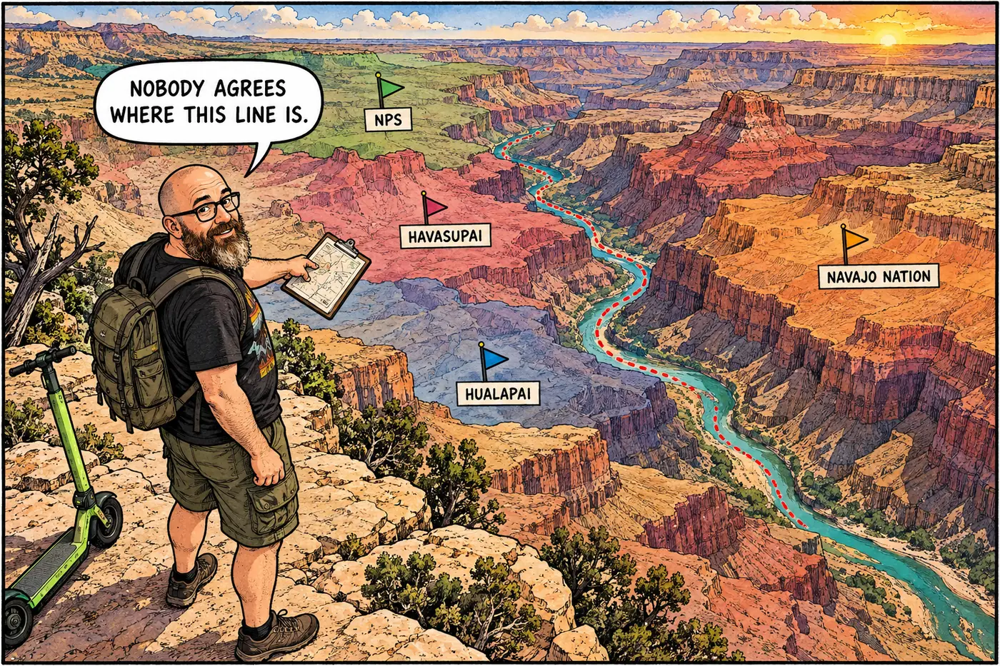
The National Park Service runs Grand Canyon National Park. It does not run the Grand Canyon. Havasu Canyon belongs to the Havasupai Tribe, a long stretch of the river's south side belongs to the Hualapai, and the eastern rim answers to the Navajo Nation — and in two of those three places, exactly where NPS authority stops and tribal authority starts is still an open legal argument.
The short version
- Eleven tribes have documented ancestral ties to the canyon, but none of them has governing or regulatory authority inside Grand Canyon National Park’s boundary — that authority is NPS’s alone, by federal law.
- The Havasupai are the exception that proves the rule: a 1975 act of Congress returned 185,000 acres to the tribe outright and carved out a 95,000-acre zone inside the park where Havasupai members keep traditional-use rights.
- Where the boundary line itself sits is disputed in two places: the Hualapai say their reservation reaches the middle of the Colorado River; NPS says it stops at the historic high-water mark, on dry land, with no river frontage at all.
- The Navajo Nation makes the same kind of argument on the east side — NPS says the reservation line is the canyon rim, Navajo Nation says it runs down to the river.
- NPS’s own current rulebook enforces the high-water-mark position against the Hualapai today, right now, on paper — this isn’t ancient history, it’s this year’s Superintendent’s Compendium.
- None of this is a National Park Service “closure.” It’s two sovereign governments and a federal agency disagreeing about where one jurisdiction ends and the other begins.
Eleven tribes, one park boundary, no shared authority
Grand Canyon National Park sits inside the ancestral homelands of at least eleven tribes. The Havasupai, Hopi, Hualapai, Navajo Nation, three bands of Southern Paiute, the San Juan Southern Paiute, Zuni, and the Yavapai-Apache all have documented historical or present-day connections to the canyon. That’s the uncontroversial part.
The part that surprises people: none of those eleven tribes has direct management authority or regulatory power inside the park boundary itself. Legal scholarship on the park’s history is blunt about it — whatever the historical and cultural ties, governing authority within Grand Canyon National Park belongs to the National Park Service, full stop. Tribes participate through consultation, cooperative agreements, and joint projects like the park’s Intertribal Working Group (running since 2013, credited with the Desert View Inter-tribal Cultural Heritage Site and the 2022-era renaming of Havasupai Gardens, formerly “Indian Garden”). None of that is the same thing as governing power.
Kaibab National Forest borders the park’s north side; the Navajo Nation borders it on the east. The Hualapai Reservation — nearly a million acres, running roughly 108 miles along the Colorado River toward Lake Mead — sits along its west side. The Kaibab-Paiute Reservation, despite deep cultural ties to the canyon, doesn’t actually touch park boundaries; it’s about 50 miles north on the Arizona Strip.
The Havasupai exception: land back into a park that surrounds it
When Grand Canyon National Park was created in 1919, it completely encircled the small Havasupai Reservation the tribe had been confined to decades earlier — a reservation reduced, after an 1880 executive order, to roughly 500 acres on the canyon floor. The reservation and the trails leading to it weren’t under NPS control, but everything around them was.
That got partially undone in 1975. The Grand Canyon National Park Enlargement Act restored 185,000 acres of plateau land on the canyon rim to direct Havasupai control — one of the larger land restorations to a tribe in U.S. history — and separately designated about 95,300 additional acres inside the park boundary as “Havasupai Use Lands,” where tribal members keep grazing and traditional-use rights under a cooperative arrangement with NPS. The park’s current Superintendent’s Compendium still carries this forward in plain regulatory text: pinyon-nut gathering limits that apply to everyone else don’t apply to Havasupai tribal members inside the Traditional Use Lands, “pursuant to the accommodations made for tribal members in the Grand Canyon Enlargement Act.”
Supai Village and Havasu Canyon itself are simpler than the Use Lands: NPS says outright that they sit “outside the boundary and jurisdiction of Grand Canyon National Park.” The tribe runs it. (More on what that means day-to-day at Havasupai lands and infrastructure.)
Where the line runs on paper isn’t settled on the water: Hualapai
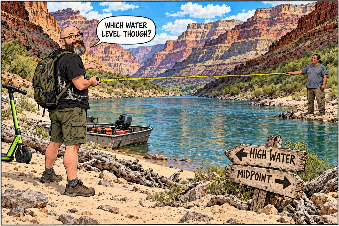
The Hualapai Reservation was established by an executive order President Chester Arthur signed on January 4, 1883, naming the Colorado River as the reservation’s northern boundary. Simple enough — except “the river” doesn’t specify which bank, or which water level.
The tribe reads that language as reaching the river’s midpoint, which would give the Hualapai actual river frontage and a share of authority over the water itself. The federal government’s position, first asserted in 1976 and reaffirmed by a solicitor’s opinion in 1999 during a separate water-rights case, is that the boundary sits at the historic high-water mark — the flood line, well up the bank, on dry ground. Under that reading, during normal river flows the tribe owns land next to the river but not any of the river.
This isn’t settled trivia. The current Grand Canyon Superintendent’s Compendium enforces the high-water-mark position as an active rule today: from River Mile 165 to River Mile 274, the compendium designates the river-left (south) side of the canyon above the historic high-water line as Hualapai Tribal Land, and requires explicit advance tribal approval for any camping or hiking there. NPS is applying its own side of a legal argument that’s never been fully adjudicated. The two sides have been managing the friction rather than resolving it — the park and the tribe now run a joint Colorado River Management Core Team to coordinate river-corridor management even without settling whose line is correct. (The Hualapai side of this — Grand Canyon West, the Skywalk, Diamond Creek Road — gets its own treatment at Hualapai lands along the river.)
Navajo: rim or river?
The Navajo Nation’s roughly 27,000-square-mile reservation runs along the canyon’s east side, with the Colorado River forming a stretch of its western edge between the Little Colorado confluence and Glen Canyon Dam. NPS holds that the reservation boundary follows the South Rim — the canyon’s edge is the line. The Navajo Nation holds that its territory extends down to the river itself.
A 1979 Colorado River Management Plan allowed Navajo Nation members to continue using and occupying land below the rim on the reservation side without resolving which government’s map is legally correct — a pattern that should sound familiar by now. Details on how that plays out day to day are at Navajo Nation lands bordering the canyon.
When jurisdiction meets ambition: the Escalade fight
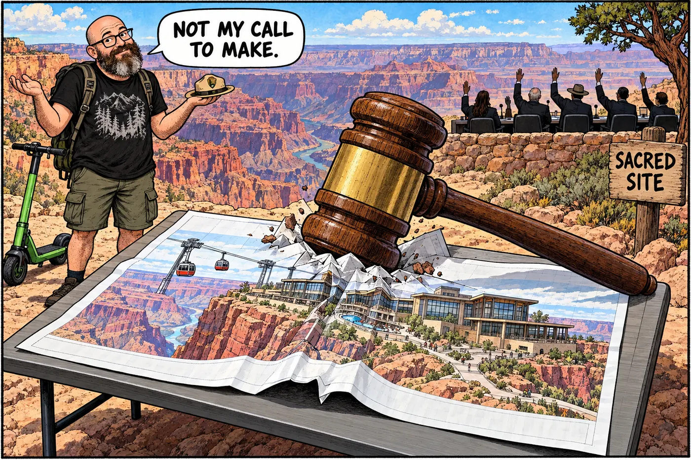
The clearest illustration of what tribal sovereignty actually means here isn’t a legal dispute with NPS at all — it’s a project NPS couldn’t block. In the 2010s, a private developer proposed the Grand Canyon Escalade: a 1.4-mile tramway plus hotels and retail, dropping visitors from the rim down near the Little Colorado River/Colorado River confluence. The site sat entirely on Navajo Nation trust land, outside Grand Canyon National Park. NPS opposed it. So did the Hopi Tribe, for whom the confluence area carries deep spiritual significance. Neither had the authority to stop it — because it wasn’t their jurisdiction.
What killed Escalade was the Navajo Nation’s own government. A special session of the Navajo Nation Council voted 16-2 against it in October 2017, after the local Bodaway/Gap Chapter — whose land it would have used — voted 55-0 to rescind its earlier approval. The Navajo Nation Council later designated the confluence area, Tooh Ahidiilíní, as a formal Navajo Nation sacred site. The federal government’s opposition was noise. The tribe’s own decision was the outcome.
What’s actually off-limits (and why)
None of the jurisdictional back-and-forth above is a “closure” in the National Park Service sense — there’s no ranger issuing a citation for crossing into Hualapai or Navajo territory the way there is for walking into the fenced Orphan Mine site. What it means in practice is simpler and stranger: two different rulebooks apply depending on which side of an unmarked, sometimes-disputed line you’re standing on. Step across the Havasu Creek/Beaver Creek confluence heading upstream, and NPS regulations stop applying — you’re now expected to pay Havasupai access fees, under Havasupai rules. Camp above the high-water line between River Mile 165 and 274, and you need Hualapai permission, not an NPS backcountry permit. None of it is secret; it’s printed in the current Superintendent’s Compendium. It’s just not the kind of “restricted area” most visitors expect — it’s a boundary between two governments, not a fence around a hazard. For the park’s own inventory of actual physical closures, see What is off-limits at Grand Canyon, and why?
An executive order establishes a reservation bordering Havasu Creek; it's soon reduced to roughly 500 acres on the canyon floor.
President Chester Arthur's executive order names the Colorado River as the northern boundary — without specifying which bank or water level, the root of a dispute still live today.
The new park completely encircles the small Havasupai Reservation.
The Supreme Court affirms Hualapai aboriginal land claims based on historic use and occupancy, reinforcing the tribe's reservation boundaries.
Congress returns 185,000 acres to the Havasupai outright and creates a 95,000-acre traditional-use zone inside the park boundary.
The federal government asserts, then a federal solicitor's opinion reaffirms, that the Hualapai boundary sits at the historic high-water mark rather than mid-river.
The Navajo Nation Council votes 16-2 against a tramway development at the Little Colorado confluence — a decision made entirely within Navajo jurisdiction, with NPS and Hopi opposition but no NPS authority to block it.
The current Superintendent's Compendium applies the disputed high-water-mark boundary as an active rule for River Miles 165-274.
Sources
- Not Yet America's Best Idea: Law, Inequality, and Grand Canyon National Park — University of Colorado Law Review
- Grand Canyon National Park Superintendent's Compendium, effective June 16, 2026 — National Park Service
- Havasupai Tribe Reservation — Grand Canyon National Park, National Park Service
- S. 1296, Grand Canyon National Park Enlargement Act (93rd Congress) — GovTrack.us
- Havasupai Reservation — Nature, Culture and History at the Grand Canyon (Grand Canyon Historical Society)
- Hualapai Reservation — Nature, Culture and History at the Grand Canyon (Grand Canyon Historical Society)
- Navajo Reservation — Nature, Culture and History at the Grand Canyon (Grand Canyon Historical Society)
- Hualapai Tribe, National Park Service in dispute — Indianz.com
- Stopping Grand Canyon Escalade Tramway — Grand Canyon Trust
- Navajo Nation Protects Little Colorado River Confluence as Sacred Site — Grand Canyon Trust
- Grand Canyon Intertribal Working Group — Grand Canyon Conservancy